파일:Countries by population density.svg

누리위키, 온 누리의 백과사전
원본 파일(SVG 파일, 실제 크기 6,000 × 2,647 픽셀, 파일 크기: 1.62 MB)

이 파일은 위키미디어 공용에 있으며, 다른 프로젝트에서 사용하고 있을 가능성이 있습니다. 해당 파일에 대한 설명이 아래에 나와 있습니다.

파일 설명

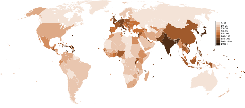
설명 A map of the world, with colours to highlight the population density of each country or territory. Numbers on the legend are in people per km2, and all countries smaller than 20,000 km2 are represented by a dot. The information was taken from en:Countries by population density.It is intended as a vector replacement for Image:World population density map.PNG. It is derived from Image:BlankMap-World6.svg, so thanks to everyone who has contributed to that. If you have any comments, suggestions, corrections, or requests for other maps, please contact me at my English Wikipedia talk page.
날짜
출처 자작
저자 Miguel Contreras, Guatemala

라이선스

Public domain 나는 이 작품의 저작권자로서, 이 작품을 퍼블릭 도메인으로 모두에게 공개합니다. 이 공개 선언은 전 세계적으로 유효합니다.
만약 저작권의 포기가 법률적으로 가능하지 않은 경우,
나는 이 작품을 법적으로 허용되는 한도 내에서 누구나 자유롭게 어떤 목적으로도 제한없이 사용할 수 있도록 허용합니다.

설명

이 파일이 나타내는 바에 대한 한 줄 설명을 추가합니다

이 파일에 묘사된 항목

다음을 묘사함

image/svg+xml

8b6b6f9d451e6f31f508d3c11e2664a26eb7522b

1,702,490 바이트

2,647 화소

6,000 화소

파일 역사

날짜/시간 링크를 클릭하면 해당 시간의 파일을 볼 수 있습니다.

날짜/시간섬네일크기사용자설명
현재2011년 12월 22일 (목) 08:332011년 12월 22일 (목) 08:33 판의 섬네일6,000 × 2,647 (1.62 MB)Quibikadded transparency

다음 문서 1개가 이 파일을 사용하고 있습니다:

메타데이터